Lake Oroville Lower Trails
Location: Oroville (Butte County) Click to view the map
Address: Lakeland Blvd
Phone: Ranger HQ 530-538-2200, Ranger Dispatch 916-358-1300
Web Site: www.lakeoroville.net
Directions: to Lower Trails - from Hwy 80 depending what part of the Sacramento area you are coming from, take Hwy 5 north to Hwy 99 north to Hwy 70 North (approx 65 miles on Hwy 70 to Oroville OR take Hwy 65 north to Hwy 70 north. For lower trails exit at Montgomery St and go east approx 1.9 miles. You will come to a round about, continue straight through round about and Montgomery will run into Orange St, turn left on Orange St continuing east for a very short ways, then turn left onto Longbar, go .9 miles road will fork and stay to the left and continue where it says no outlet. Then left on Colina you should be seeing staging area signs now, follow signs. Colina turns left onto Fernwood, then make a right on Lausen - staying on the paved roads. Then left on Lakeland, follow to end of pavement, continue on gravel road which will veer left and end at the staging area. Staging area is approximately 4.5 miles off Hwy 70.
Amenities: picnic tables - day use only
Staging area: very large flat area. Mix of grass and gravel. Any size rig will fit and area can accommodate quite a few rigs. A few shade trees along the sides, backs up to the diversion dam. There are several picnic tables. Area was patrolled several times when we were there - March 2013.
Dogs: allowed on leash
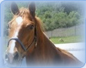
Trails: Very nice trails, some single track, some fire break road. Quite rocky but nothing we went on was very steep or technical. Trail maps are available at the visitor center (530-538-2200)
Water: no water available at staging area. Places along the trail to let your horse drink and /or cool off, one being Longbar pond.
Restroom facilities: 1 port a potty
Other info: Beautiful trails especially in the spring when everything is green but lots of poison oak. Heard that the rattlesnakes come out as the weather warms. Some nice views from some of the trails views of Shasta and Table Mountain. There is also the famous old tunnel that you can ride though. It is very dark turn on light before entering box at side of trail near entrance see trail pics. For more history on the tunnel go to http://djkuba.tripod.com/index-5.html
Fees: free for this staging area
See trail pictures tab located to the left of this page for photos and more information.
Print this page to take with you for reference.
Friendly reminder, be smart, do not leave any valuables in your vehicle or trailer.